 Directions
Directions from the intersection of US-231 and South River Road near West Lafayette, IN
Head west on South River Rd. You will be following this road for 8.2 miles before the next turn.
Along the way you will see Fort Quiatenon at the 2.5 mile mark.
At the 3.9 mile mark, continuing straight, the road becomes Division Road.
At the 4.0 mile mark, you will cross Jordan Creek.
At the 6.4 mile mark, you will cross the intersection of CR 700 W (Granville Bridge Road).
At the 6.5 mile mark, you will see the turn off for the Tippecanoe Parks – Granville Access.
At the 6.7 mile mark, you cross Indian Creek.
After winding up Indian Hill, at 8.0 miles you will travel beside the Ravines Golf Course.
At the 8.2 mile mark, near the western edge of the Ravines Golf Course turn left (south) onto CR 875 W
Travel south 0.5 miles on CR 875 W which turns right (west) becoming CR 50 S
Travel west 0.5 miles on CR 50 S which turns left (south) becoming CR 925 W
Travel south 0.25 miles on 925 W which turns right (west) becoming CR 75 S (this is at the entrance to Ross Camp, the old 4-H Center)
Travel west 0.25 miles on CR 75 S and turn at the first left (south) onto CR 950 W
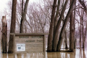
Traveling south on CR 950 W, at the 1.0 mile mark the road winds downhill, at 1.4 miles you cross a small bridge and arrive at the Wabash Bottoms – Janssen Tract parking area on your left.