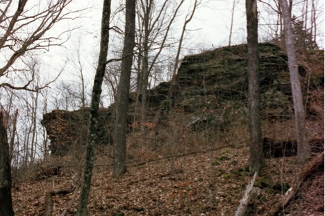
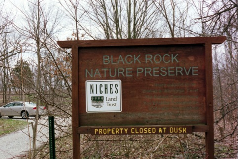
A prominent feature along the banks of the Wabash River, Black Rock is a Mansfield sandstone outcrop rising 100 feet above the river. The uniqueness of this property’s features and its status as a state nature preserve make it a location worth visiting. The locale packs a lot of interesting geology and nature in an area covering only 47 acres.
With its proximity to Weiler – Leopold Nature Reserve / Black Rock Barrens (link to — our page on this property)and Wabash Bottoms (link to — our page on this property), a visit to this location can easily be combined to visits to these other locations to expand your appreciation of the area.
 Directions from the intersection of US-231 and South River Road near West Lafayette, IN
Choice #1 – Head west on South River Rd. You will be following this road for 8.2 miles before the next turn.
Along the way you will see Fort Quiatenon at the 2.4 mile mark.
At the 3.9 mile mark, continuing straight, the road becomes Division Road.
At the 4.0 mile mark, you will cross Jordan Creek.
At the 6.4 mile mark, you will cross the intersection of CR 700 W (Granville Bridge Road).
At the 6.5 mile mark, you will see the turn off for the Tippecanoe Parks – Granville Access.
At the 6.7 mile mark, you cross Indian Creek.
After winding up Indian Hill, at 8.0 miles you will travel beside the Ravines Golf Course.
At the 8.2 mile mark, near the western edge of the Ravines Golf Course turn left (south) onto CR 875 W
Travel south 0.5 miles on CR 875 W which turns right (west) becoming CR 50 S
Travel west 0.5 miles on CR 50 S which turns left (south) becoming CR 925 W
Travel south 0.25 miles on 925 W which turns right (west) becoming CR 75 S (this is at the entrance to Ross
Camp, the old 4-H Center)
Travel west 0.25 miles on CR 75 S and turn at the first left (south) onto CR 950 W
Traveling south on CR 950 W, at the 1.0 mile mark the road winds downhill, at 1.4 miles you cross a small
bridge and pass the Wabash Bottoms property on your left, the road angles southwest, you then
travel up a hill and at the 2.9 mile mark you reach the top of the hill and the Black Rock parking
area on your left. (You have traveled 12.6 miles from the beginning at US-231 & South River Rd.)
Choice #2- Head west on South River Rd. You will be following this road for 10.3 miles before the next turn.
Along the way you will see Fort Quiatenon at the 2.4 mile mark.
At the 3.9 mile mark, continuing straight, the road becomes Division Road.
At the 4.0 mile mark, you will cross Jordan Creek.
At the 6.4 mile mark, you will cross the intersection of CR 700 W (Granville Bridge Road).
At the 6.5 mile mark, you will see the turn off for the Tippecanoe Parks – Granville Access.
At the 6.7 mile mark, you cross Indian Creek.
After winding up Indian Hill, at 8.0 miles you will travel beside the Ravines Golf Course.
At 9.4 miles the road surface changes (still paved) as you cross the Tippecanoe County –
Warren County line and the road name changes to 700 N.
At 9.9 miles the road makes a 90 degree turn south (left) and becomes 1150 E.
At 10.1 miles the road turns back west (right) and becomes 675 N.
At 10.3 miles you need to turn before entering Greenhill (see directions below).
At CR 1125 E in Warren County (just before you enter the small town of Greenhill) turn left (south).
(You will be traveling south and west on Independence Road, so named as it eventually ends in Independence, IN.)
After 1.7 miles 1125 E turns right (west) becoming 500 N.
After 0.25 miles you are forced to turn back south (left) as the road becomes 1100 E.
After 1.5 miles turn left (east) on to CR 350 N, which is a gravel road.
Travel 0.5 miles to the parking area for Black Road Nature Preserve on your right.
(This is just before the road curves down the hill to the Wabash River, and eventually in another 1.4 miles to the Wabash Bottoms site.) (You have traveled a total of 14.25 miles from US-231.)